
Home
Tours and Tales
Toy Run '07
Cold Kiwi '06
Hakarimata '06
Whangarei '92
Riding Tales 1
Riding Tales 2
Future Rides
Site Map
New/Updated Pages
Contact Me
Riding Journal
Hamilton to Hakarimata Range Ride, 29 July 06
Bike: 2003 Yamaha XT225
My friends on the XT225 forum charged me with the responsibility of getting some pictures of my XT225 amid some of New Zealand's scenic splendour - not as simple a task as it may first seem given that those asking were enjoying a Northern Hemisphere Summer whilst those of us "Downunder" were suffering through Winter, which is not exactly conducive to getting pictures of anything but rain.
Generally, when I go for a ride there's no planning involved - I look at the weather, decide it looks a great day for a ride, suit up, jump on the bike and set off in whichever direction takes my fancy. Where I go and what route I take to get there is a matter of whim - sometimes it's scenic, other times I'm too busy enjoying the ride to care what the scenery looks like.
Obviously, the task set by my fellow XT enthusiasts was going to require more planning than that as there were several matters to be considered - the first of which was notifying my wife that if the weather was fine on Saturday, she'd be stuck with looking after the kids while I buggered off and enjoyed myself. (Admitting that she was fine with this as I'd previously looked after the kids while she went out with friends would probably ruin my Kiwi-Bloke Cred, so I won't mention it.)
The next consideration was "Where". I was to take pictures in scenic locales befitting the XT's capabilities so obviously tootling around the fairly flat farmlands that surround Hamilton or riding up State Highway 1 to Auckland and back was not going to be sufficient. Especially not by comparison with the excellent pictures and ride reports from other members of the forum.
My first thought was to go over the Kaimai mountain range to Tauranga and Mount Maunganui and get some shots of the mountains, some New Zealand native bush and the ocean. I wasn't 100% happy with the plan as it would mean riding through a lot of relatively boring flat dairy-farm country to get to the Kaimai Range and I would be riding on State Highway 1 and State Highway 29, two heavily trafficked and fairly well-maintained main roads - hardly befitting the capabilities of the XT. The route to Rotorua and its scenic splendours (SH1 then SH5) was likewise mostly boring and too tame for the XT. I mean, people take those routes at insanely illegal speeds on pure street bikes (probably to reduce the time they spend on such boring roads). Taking routes other than the State Highways would merely mean spending even longer on flat dairy-farm country roads.
I wracked my brains for suitably scenic and befitting ride for the XT and could think of nothing. I had to come up with something! The only time I had taken the XT outside the city limits since I bought it was a brief trip up River Road to the neighbouring town of Ngaruawahia and my Adventure Rider Cred was at risk.
Ngaruawahia, 19km along SH1 from Hamilton, a 15 minute trip, not a lot further via River Road on the East side of the Waikato River. Pah, I could walk that distance, I've ridden a bicycle to it - in fact, I rode a bicycle through it when I rode out to my uncle's farm at Waingaro...
And it was whilst thinking along those lines that it occurred to me where I could take my XT.
After spending most of the preceding week planning and hoping the weather would be as fine on Saturday as it was during the week, I was getting quite anxious. It would not be fair, I felt, for it to be beautiful weather on the days when I had to work, only to rain on the one day I had booked to go for a ride. The weather throughout the week was cold, clear nights and frosty, clear mornings leading to sunny, clear days so when the chill set in early Friday evening I was confidant that I'd have great riding weather the following day.
Nature, pernicious as she is, had a surprise in store, however.
Saturday dawned not merely frosty but foggy - a combination that not merely means being cold and having no visibility, but also having fog condense on visor and armour and then freeze in the sub-zero wind. Not ideal conditions for a relaxing ride or taking photos; I could only hope that the fog would bleed away quickly and not hang around for half the day as it has been known to do.
After faffing around packing a lunch, drinks and first aid kit, getting batteries for the digital camera and filling up with fuel it was 10:30 in the morning by the time I rolled away from the Service Station some 400 metres from home. The fog had bled away leaving me with a beautiful clear sky and the promise of a fine day.
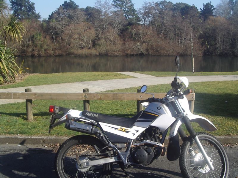
Rather than take State Highway 1, which is crowded, ugly and boring (I was on a scenic ride after all), I crossed the to the East side of the Waikato River at the Fairfield Bridge and went onto River Road where I stopped to get a picture of the bike at one of the parking areas by the river. It was my intention to get further shots of the bike next to the river at various points on my return journey but unfortunately I ran out of space on the card.
The 50km/h zone quickly (but not quickly enough) gave way to the 80km/h zone past all the so called "Lifestyle Blocks" - in this case larger than average properties in what was once a rural area (and a 100km/h zone) with large, expensive houses on them. Unlike a proper lifestyle blocks, these properties do not have farm animals making the place look untidy and the houses all have wide paved driveways so their stylish 4x4's don't have to park on the lawn and risk getting dirty tyres.
After the pseudo lifestyle blocks is farmland. Because the road runs close to the river, the land is contoured here, gentle hills and valleys - not as flat as most of the dairy area around Hamilton, but not challenging. The speed limit is 100km/h and the road is an easy ride.
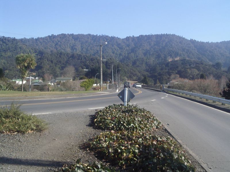
On the way to Ngaruawahia I rode back into thick fog and I was worried I would not be able to take some of the photos I had planned but fortunately I rode out of the fog again before I reached Ngaruawahia where I made a brief trip along State Highway 1, briefly doubling back towards Hamilton and crossing back to the West side of the river. I turned west and stopped just before the bridge that leads to Waingaro Road for another photo.
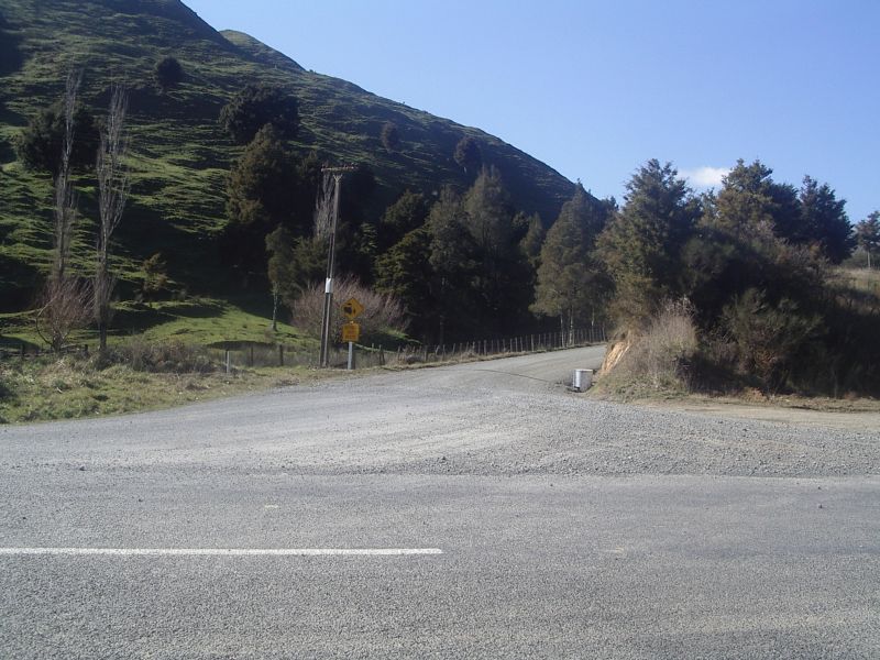
To the left at the end of the bridge is Waingaro Road, the direction I was heading, to the right is Hakarimata Road, the route by which I would return. Directly ahead is the Hakarimata Range, a low range of fold mountains, in and around which my day's ride would take place.
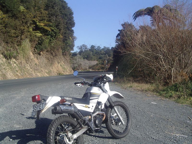
After leaving Ngaruawahia I stopped the bike at the first sight of the Hakarimata Scenic Reserve and took a photo. I also took this as my first cigarette break before launching myself into the winding roads of the Hakarimata Range. Please note, we ride on the left hand side of the road here in New Zealand but the bike is to the right as I pulled into a gravel area across the road for this shot.
Not long after setting off again I startled a hawk from its meal of road-kill and it flew across my path a safe distance from me.
Here the road twists and turns up hill and down dale, winding through native forest, cultivated pine forests and hilly sheep farms. The topography is often called "rolling hills". Everywhere, small to large streams meandered through the bush or the farm properties. I hadn't ridden Waingaro Road for years, not since my uncle sold the farm he had out here, and I was out of practise. This was a road I had regularly travelled at 100km/h but I found myself slowing down a lot and taking the corners very cautiously, mindful that if I took a fall I was on my own.
I had hoped to have a friend join me on the ride but the three I asked were unable to go that day.
The farm that used to belong to my uncle was dramatically changed and the property had been split up - there was another new house nearby and the driveway to it looked as though it passed through where my uncle's shearing shed used to be.
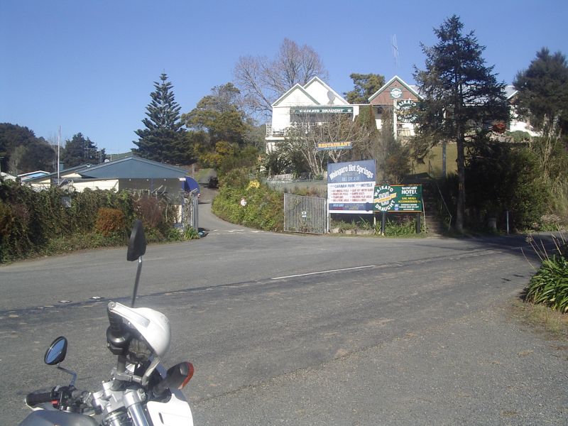
I stopped to take a photo of the Waingaro Tavern and the hot pools and decided against having a cigarette break as it was only about 15 minutes since I had one at the beginning of the Scenic Reserve.
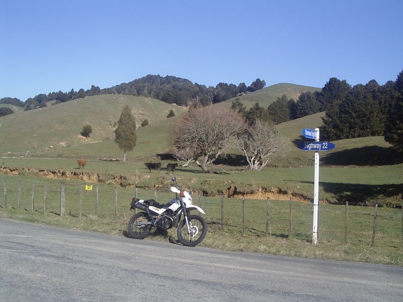
A little further up the road, Waingaro Road merged onto Highway 22 which was not noticeably different from Waingaro Road. When I located Otorohaea Trig Road I stopped for a cigarette, a cold drink and a snack. While stopped I took pictures of the Otorohaea Trig Road vanishing around the corner...
...and of the farm I was parked beside. This is typical of the farms in the area: rolling hills given over mainly to sheep but this farmer, like my uncle, grazes a few cattle on the flatter bits. The rift running through the paddock is one of the ubiquitous streams that I mentioned earlier.
Otorohaea Trig Road was very winding and steep and made of packed earth with gravel on top. I found it hard going and I reduced my speed to a crawl.
As I wound my way up the hill and down the other side, shifting up and down through the bottom three gears I mused that I was not going to make it onto the front cover of Adventure Rider Monthly at this rate.
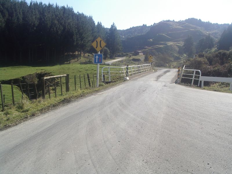
Finally the road levelled out past a gravel quarry and I crossed a one-lane bridge and arrived at Rotowaro Road. The picture is looking back the way I came. You can see the road zig-zagging down the hill in the distance.
Even though I was back on tarmac I did not know the road so I took it easy until I passed Glen Afton and the road straightened out somewhat so I could open the throttle a bit more.
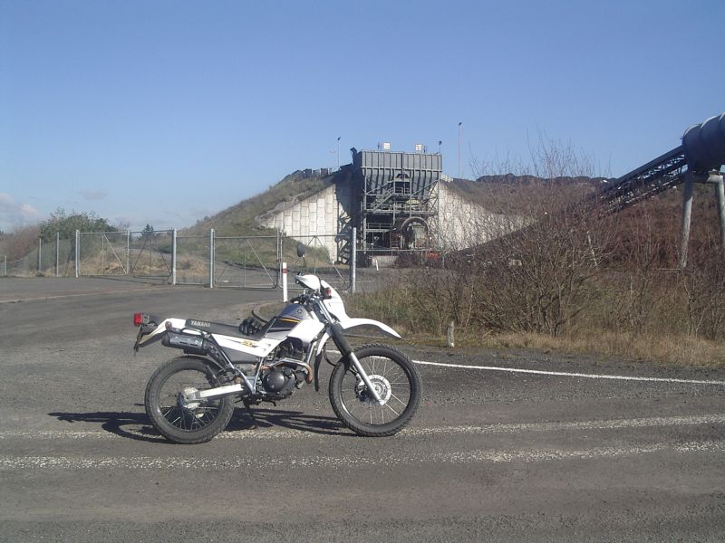
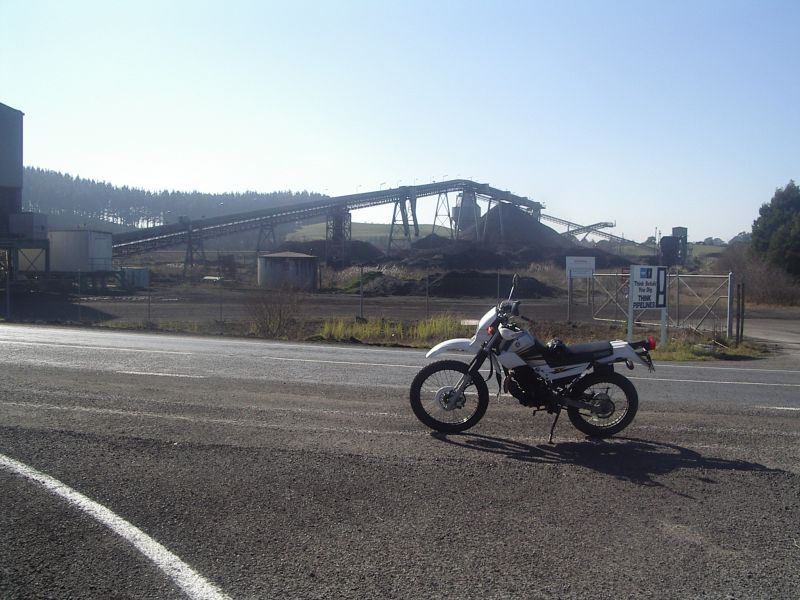
At Rotowaro is a huge open cast mining area and the road passes through a short tunnel beneath a huge causeway that links the mining areas on either side of the road. Not long after that I turned off onto Waikokowai road which I know well. I paused here to take photos of the coal processing equipment and conveyor pipe.
As I know Waikokowai road well I made good time to the Waikokowai village and stopped at a friend's house for a couple of coffees and cigarettes and a chat.
Leaving the "Waikokowai Café", I then continued along Waikokowai Road, once again at reduced speed as I did not know the road. Here was very little bush and mainly open farmlands.
By now, after spending so much time in the saddle, I was beginning to feel the strain. I had left Hamilton on a Yamaha XT225 and now I had a BSA - "Bloody Sore Arse". Finally I could understand what my fellow XT enthusiasts meant by the term "monkey butt" and why most were in favour of customising the seat.
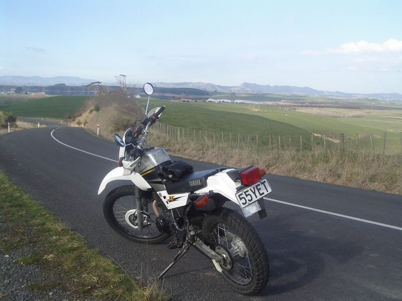
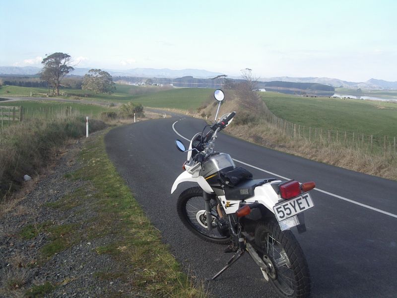
I arrived at Rotongaro village and took Rotongaro towards Rangiriri. The road was fairly tame here and I was able to get up to reasonable speeds despite not knowing the road. No native forest here, just farms and some lakes. I stopped and took a couple of photos of the bike with Lake Rotongaro in the background and carried on.
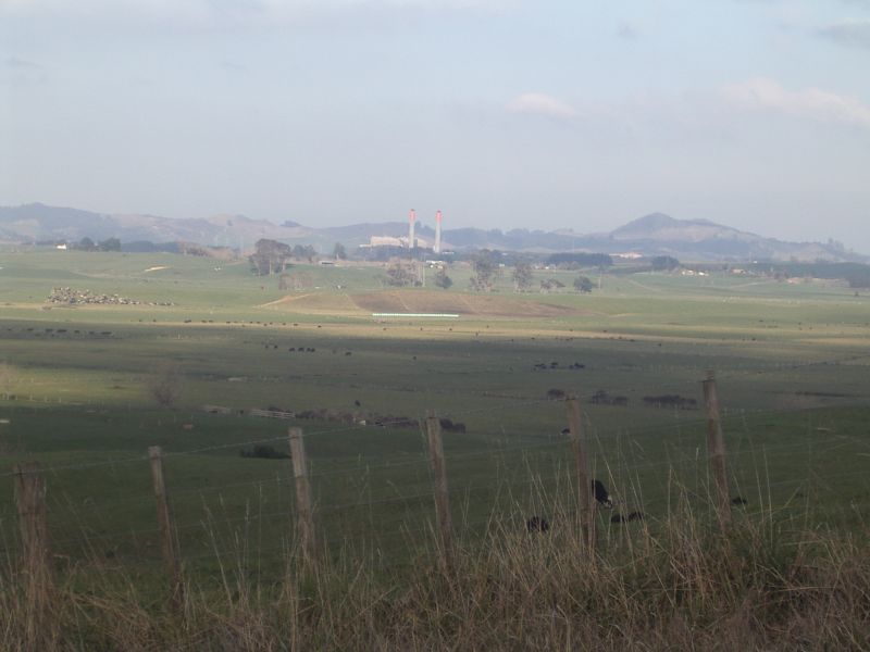
From the same spot I took a shot across the farmland of the Huntly Power Station (coal fired) in the distance.
I finally arrived at Glen Murray Road and turned east towards the river. The road was fairly straight and boring so I took the bike up to 100km/h and got it over with.
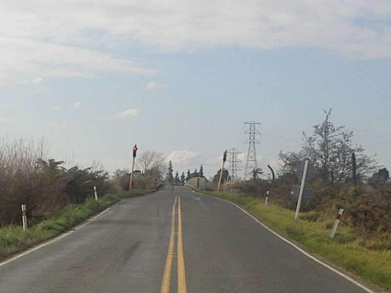
At Te Ohaki Road I elected to take a brief detour due North to get a shot of the Rangiriri Bridge, a long one lane bridge that spans the Waikato River and some marshland. It has traffic control lights on it as you cannot see the length of the bridge and determine whether or not it is safe to traverse.
At the other end of the bridge is State Highway 1 with the townships of Rangiriri and Te Kauwhata. This is the point where we cross over and regretfully go onto SH1 whenever we travel to Auckland and where we thankfully leave SH1 to take the back roads home on our return journey.
Unfortunately this was the last shot I was able to take before I ran out of space on the camera's memory card.
I turned the bike around and headed south and homewards down Te Ohaki Road. As this is our preferred route home to avoid SH1 and all its traffic, I know the road well and was able to travel at 100km/h unless forced to slow for 65km/h corners.
I got to Huntly West in good time, rolled sedately through the 50km/h zone down Harris Street and Riverview Road then continued on down Hakarimata Road to Ngaruawahia at a steady 100 except for those pesky 65km/h corners.
As previously mentioned, I emerged into Waingaro Road and swung across the bridge pictured earlier and had another cigarette, cold drink and snack at a little park just to the West of SH1.
My return home from Ngaruawahia was back the way I came - a short jaunt up SH1, over the Ngaruawahia Bridge to the East side of the river, and down River Road to Hamilton.
I stopped and fuelled up at the same Service Station as before. I had travelled 148.2 kilometres and required 5.05 litres of petrol - around 29 kilometres per litre.
The following map covers the route I took:
Hakarimata06